Aerial sensing and analysis
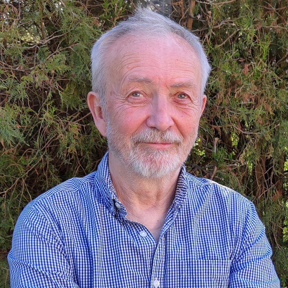
My name is László Molnár. I am a cinematographer and photographer. I have four decades of professional experience, including the creation of aerial videos and photographs. The development of technology has made it possible to use drones with high efficiency both in agriculture and in many other areas of life. (...)
Read more
My name is Máté Kotroczó. I am an IT specialist, programmer, and teacher. I have been working in programming, website development, and solving a wide variety of IT problems for 15 years. My goal is to make data understandable, enrich and format it, and turn it into a user-friendly experience. (...)
Read more
We create special aerial photos and videos
For details, choose from the 6 options below!
Panoráma Képeslap
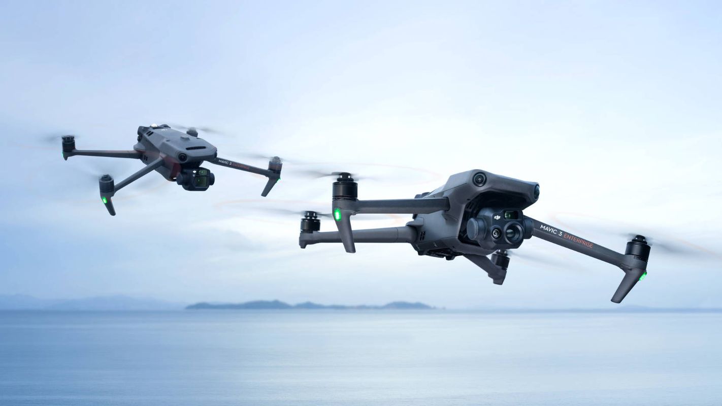
What do we fly?
DJI Mavic 3 – Imaging above all
We use DJI Mavic 3 industrial drones to collect raw data for aerial sensing and analysis tasks.
The DJI Mavic 3 redefines industry standards for drones. With a mechanical shutter, a 56× zoom camera, and an RTK module providing centimeter-level accuracy, it elevates mapping and mission efficiency to new heights. The thermal version is available for firefighting, search and rescue, inspections, and night operations.
The Mavic 3M is used for capturing multispectral images of vegetation. With its help, we can reconstruct high-resolution maps of orchards and automatically identify the number of living organisms or trees. This allows us to distinguish trees from other obstacles or objects and generate three-dimensional operational routes for agricultural drones, ensuring more cost-effective operation.
Shared features of our drones
- Safe and stable
-
- Omnidirectional obstacle avoidance
- 15 km transmission range
- Precise positioning
-
- Centimeter-level RTK positioning
- Microsecond-level time synchronization
- Efficient aerial surveying
-
- Up to 200 hectares (2 km2) per flight
- Maximum flight time 35 minutes on a single charge
- Four-antenna O3 Enterprise transmission
- Omnidirectional spatial sensing
- Pre-plannable automatic flight routes
DJI Mavic 3M
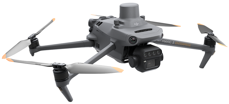
For efficient aerial surveying, we must see the invisible. That is why the Mavic 3 Multispectral offers two types of vision. It combines an RGB camera with a multispectral camera to scan and analyze vegetation conditions with complete clarity. Agricultural production management requires precision and data — the Mavic 3M delivers both.
- Multispectral camera
-
- 4 × 5 MP resolution
- G/R/RE/NIR (Green, Red, Red Edge, Near InfraRed)
- RGB camera
-
- 20 MP resolution
- 4/3 CMOS sensor
- Mechanical shutter
DJI Mavic 3T
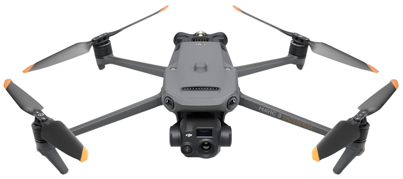
The Mavic 3 Enterprise Thermal (M3T) is part of DJI’s advanced Mavic series, equipped with both thermal and standard cameras. Thermal images and videos allow wildlife monitoring even at night, enabling more accurate estimation of animal populations. It collects visual and thermal data for ground-level inspection of solar power plants and other utilities. It is also suitable for rescue operations in hazardous environments, such as disaster zones or search and rescue missions.
- Fast surveying
-
- Equivalent focal length: 162 mm, 12 MP
- 0.7-second interval shooting
- Focus and search
-
- Up to 56× hybrid zoom
- 23× split-screen zoom
- Thermal camera
-
- Reveals the invisible
- Thermal sensor resolution 640 × 512 pixels
- DFOV (diagonal field of view) 61°
- Equivalent focal length: 40 mm
- Spot and area temperature measurement
- High-temperature alert
- Helps locate targets Fast decision-making
Rise Above!
See everything through our eyes!
Do not hesitate! Get in contact with us today!